SpaceStationAR is an intuitive satellite-observation app that uses augmented reality.
It predicts when and where satellites will appear and overlays that information on the real scenery.
Which satellites does it support?
This app focuses on satellites and spacecraft that have a realistic chance of being seen with the naked eye. Its main targets include the ISS (International Space Station), Starlink trains, the Chinese Space Station (CSS), and the Hubble Space Telescope.
It also supports various cargo spacecraft and other visible satellites such as Biomass, BlueWalker 3, Daichi-4, SAOCOM, Resurs DK1, ENVISAT, and the SpaceMobile series.
Newly launched satellites are automatically added when they become potentially visible.
When can satellites be seen?
Space stations orbit Earth roughly every 90 minutes, but you can only see a satellite when it is sunlit while your sky is dark enough.
SpaceStationAR calculates those opportunities for you, which usually means dawn or dusk.
How accurate is SpaceStationAR?
In normal use, the app is designed to remain accurate enough to help you find satellites.
We try to keep azimuth error within 15 degrees and timing error within 10 seconds, but errors tend to grow when a pass goes near the zenith.
What's the difference between the free edition and the paid / pro edition?
The paid / pro edition includes Night Observation Mode and the sky-chart view for satellite passes.
In the free edition, ads are displayed and AR viewing of a satellite pass is limited to the 30 minutes before the pass.
Do I need any equipment to see satellites?
For bright targets such as the ISS or a Starlink train, you usually need nothing but your eyes.
The ISS is brighter than most stars in the sky, so if you can find a single star, you can usually spot the ISS too.
How can I tell satellites apart?
They appear to move at about the same speed as airplanes, but one clear difference is this: satellites do not blink! They also tend to look brighter when they pass higher in the sky. Example video
Does it support newly launched satellites?
Yes.
Newly launched satellites are added automatically when they have a realistic chance of becoming visible.
Your device needs to be online to fetch the latest orbital data.
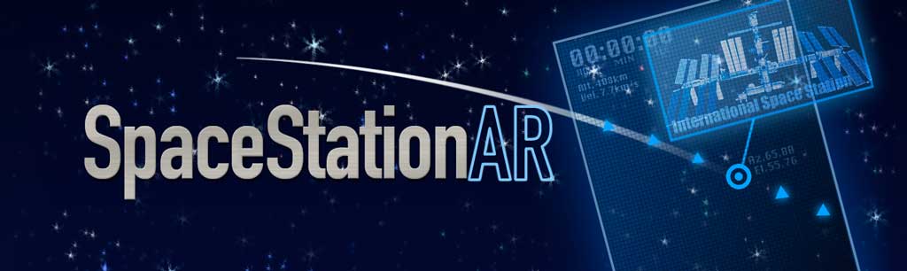
What do the numbers on the "MAP" mean?
The number next to the blue dot (your current position) shows the satellite's brightness magnitude at that time.
For Starlink trains, individual satellites are shown separately.
Why does a particular satellite never appear in the calendar?
Visible passes are not distributed evenly. Sometimes a satellite is visible frequently, and sometimes it does not appear for weeks. Visibility also depends on your latitude. Satellites that fly near the equator, meaning satellites with small orbital inclinations, are hard to see or completely invisible from high-latitude areas. For example, the ISS (orbital inclination 51.6 deg, altitude about 420 km) can produce passes of 15 deg or higher only up to about latitude 65. The Hubble Space Telescope (orbital inclination 28.47 deg, altitude about 540 km) is always invisible above about latitude 51. The Chinese Space Station also has a smaller orbital inclination than the ISS, so it may not be visible from high latitudes. Starlink trains are temporary after launch, and their orbits differ from mission to mission, so whether you can see them depends strongly on the launch and your location.
Predictions that used to appear in the calendar have disappeared
Satellite predictions are calculated on the assumption that the satellite will keep its current orbit, but satellite orbits can change.
The ISS in particular often performs reboost maneuvers to maintain its altitude.
If a satellite's orbit changes, the app recalculates predictions using the updated orbit, and as a result the visible-pass entries in the calendar may change or disappear.
The heading in AR view seems misaligned
In AR view, the app uses your phone's magnetic sensor to determine direction, but magnetic sensors are affected not only by Earth's magnetic field but also by surrounding magnetic interference.
This is especially common when you are in a vehicle or near metal-heavy buildings or bridges.
In such cases, switch "Compass" to "Manual" in the Settings tab. You can then rotate the AR view by flicking it with your finger.
If you already know the correct direction, or can align the view using a visible celestial object as a reference, manual adjustment may help you follow the satellite path more accurately.
How can I reduce battery usage?
The augmented-reality view consumes battery relatively quickly because it uses the camera and several sensors.
You can save battery by using AR only when you need it. Other views, such as Map and Calendar, consume much less battery.
If your battery is running low, we recommend turning on Low Power Mode in iOS Settings.
What OS and hardware does it require?
On iPhone and iPad, the app supports iOS 15.6 or later. On Android, it supports Android 6.0 (Marshmallow) or later.
AR viewing requires camera access, and on iPhone and iPad it requires a usable back camera.
Pass prediction depends on location access, although manual location selection is also supported.
For the best AR experience, motion and orientation sensors are recommended for proper direction handling.
I found a bug or have a request
If you found a bug or have a request, please send it to us using the contact form.
Who built this app?
We're Toriningen Inc. in Tokyo, Japan. The team consists of two members, @hisashin and @MaripoGoda. The app was originally released in 2009 under the name "ToriSat". We are always happy to hear your feedback via Twitter or email.